Wiky Geomatics
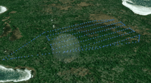
Wiikwemkoong’s Department of Lands & Natural Resources (DLNR) has expanded it’s capabilities to include core technology consisting of high-quality multispectral imagery and high resolution LiDAR, capture via unmanned aerial vehicles (drones). Wiikwemkoong’s DLNR Geomatics Department seeks to form strategic alliances and partnerships with forestry consulting firms to join in pursuing opportunities in the afforestation, carbon offset monitoring, aggregates, mining, and civil engineering sectors.
In its early stages, DNLR is looking to focus its efforts on the Great-Lake St. Lawrence forest region of Ontario where the diversity of landscapes and tree species/forest types require a more granular and detailed understanding of forest inventory and where continuous inventories are necessary for effective and efficient forest management planning and operations. Although an early emphasis will be placed on foresty related services, DLNR is interested in exploring opportunities associated with other sectors in the region.

Our Technology
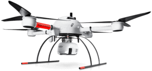
mdLiDAR 1000HR aas
Industry-leading drone LiDAR survey equipment and software. High-resolution point clouds and increased coverage.
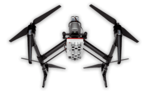
RedEdge-MX Dual Camera Imagining System (DJI UAV)
Synchronized 10-brand imagery for advanced remote sensing solutions.
Our R&D Focus
Forestry Operations
Woodlots, private landowners, inventory updates – planning, inventories, and orthomosaics
Forestry Renewal & FTG
Stocking, survival, height, health, species identification in smaller areas in GLSL region primarily
Afforestation
Planning – land identification & site-specific assessment. Stocking, survival & height
Mining & Aggregrates
Material deposits, tailings pond condition, cut/fill analysis, site analysis
Property Mapping
Mapping products, building information, imagery products
Wiky Geomatics Contact
Suzanne Gunn
GIS Specialist, Business Lead
Wiikwemkoong, Manitoulin Island
& Searchmont, Algoma District,
Ontario, Canada
(250) 910-9867


